Site Near Oso Had Previous Landslides, Potential For More

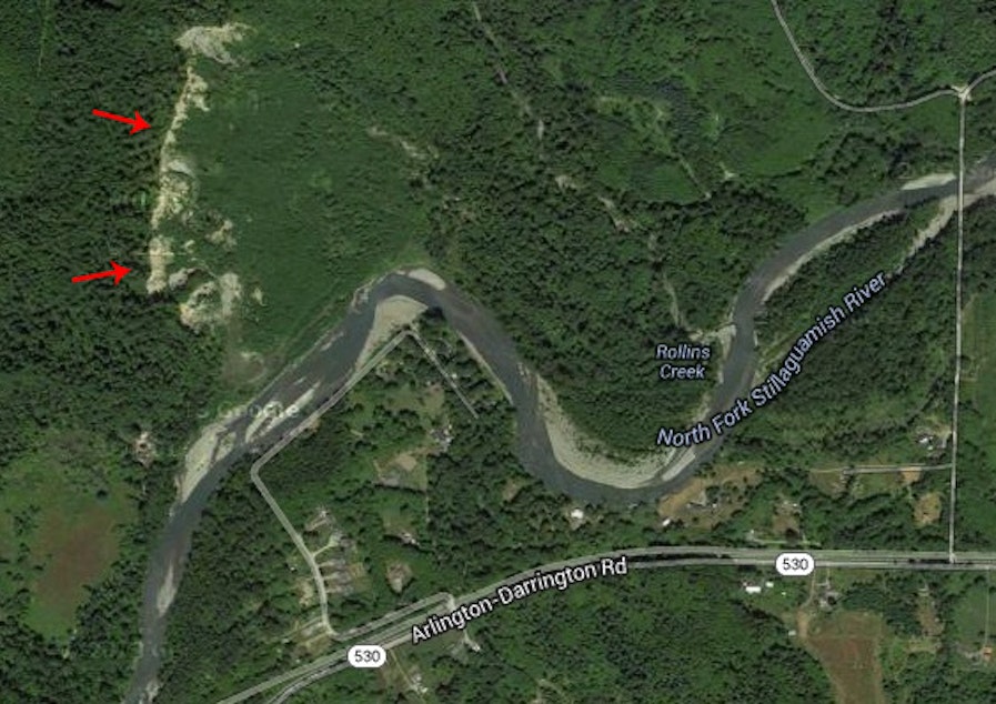
Satellite images show the area on the Stillaguamish River near Oso, Washington, experienced a landslide in 2006. According to the Sliding Thought Blog, the "Hazel Landslide" that year was caused by groundwater and erosion by the north fork of the river.
University of Washington geologist Dr. Dave Montgomery described possible causes of Saturday's landslide and its potential for similar future events.
1. The hillside itself was a fairly weak glacial material, and the river was cutting into the base of it (see map above). “You have this situation with the river undermining a relatively unstable slope, and you also had the wettest March in history — it’s a recipe for causing a slide,” he says.
2. He believes this location experienced a landslide in the past. In the Google Earth image above, he points out the trace of a landslide scar that predates the current one, so the slope was already unstable. As a result, the landslide was reactivated in a much more dramatic and violent fashion than in the past.
3. Logging may have been a contributing factor. He says there are a lot of arguments about the way in which forest practices affect deep-seated slides. “That question will be asked and looked at, and I think it’s a pertinent question, but I don’t think the answer is as obvious as some might think,” he says.
Sponsored
4. Precipitation may have been a contributing factor. "We had a very wet March and that was definitely a contributing factor ... If we get more intense rainfall in the future, we should have more landslides; if we get more soaking rainfall and get more rainfall total, we should have more landslides ... And this region is already landslide-prone."
Regional Landslide Resources
