Glacial rivers rage as heat wave bites into Northwest snowpack
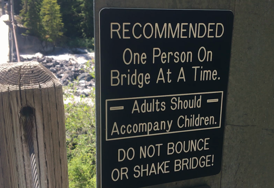
Deep inside Mount Rainier National Park, there’s a shaky suspension bridge above a rushing river.
“DO NOT BOUNCE OR SHAKE BRIDGE!” reads a warning in all caps.
If fear of heights doesn’t stop you, it's a great place to look up at the snout of Mount Rainier’s deepest river of ice, the Carbon Glacier, with the snow-capped summit of the volcano behind it.
It's also a great place to look down and listen to the milky water of the Carbon River.
On one of the extremely hot afternoons of the Northwest’s record-exploding heat wave, the river is swollen with thick gray meltwater, opaque from all the glacial sediment it carries.
The river rages so hard that boulders that have fallen out of the retreating glacier tumble along the river bed, clacking and thundering invisibly along the bottom.
It’s a mesmerizing but disconcerting sound: Echoes of a changing climate, as an extreme heat wave on top of a warmer global atmosphere combine to make mountain snow melt sooner.
Sponsored
The Northwest’s extreme heat wave made life difficult in the lowlands, killing nearly 600 people in British Columbia, Oregon, and Washington.
In the mountains, the record-shattering heat took a bite out of the region’s critically important alpine snowpack and sent it pouring downhill.
Downstream of the Carbon Glacier, “very high levels of meltwater from the extreme heat” overran a log footbridge across the Carbon River, the National Park Service reported, making it impassable.
Another low bridge across Mount Rainier's glacier-fed Nisqually River was pushed aside by the thundering waters, but park officials said immediate damage from the high flows was minimal.
Sponsored
“Definitely expected to see it in an extreme heat wave,” Mount Rainier National Park geologist Scott Beason said in an email. “I’m a little surprised some of the rivers weren’t higher, to be honest.”
In the long term, the heat-driven pulses of dirty water build up riverbeds downstream with fresh deposits of rock and sediment. The rising beds lift the rivers running over them, worsening the impacts of floods on the park’s roads, campgrounds, and buildings.
Much of Mount Rainier National Park’s infrastructure is now protected by dikes from the ever-rising rivers running nearby.
A two-mile stretch of Highway 410 now sits 14 feet below the adjacent White River on the east side of the park.
Glaciers melt to some degree each summer, providing streams with cool water, and are replenished with new snow each winter. As carbon emissions have heated the earth’s climate, that balance has tilted for the Carbon, named for the coal deposits once mined in its valley, and other glaciers.
Sponsored
Most of the world’s glaciers are shrinking and losing their ability to keep summer streams flowing and cool.
In the North Cascades, the recent heat wave boosted the water temperature of the South Fork Nooksack River by 5.4 degrees Fahrenheit, according to Nichols College glaciologist Mauri Pelto.
On the nearby North Fork Nooksack River, fed by glaciers on Mt. Baker, temperatures rose just 1.4 degrees.
“Ongoing climate change will cause further decreases in summer baseflow and an increase in water temperature potentially exceeding tolerance levels of several Pacific salmonid species,” Pelto writes.
In the mountains surrounding Puget Sound, this year’s snowpack lasted just about as long as the 30-year average, according to dozens of high-elevation snow gauges monitored by the U.S. Department of Agriculture. The extreme heat hit near the tail end of the snowpack’s seasonal reign.
Sponsored
East of the Cascades, much of the snowpack had already melted away, earlier than usual, bad news for irrigators, firefighters, and fish.
“When I see that, I just get more concerned for later in the summer,” assistant Washington state climatologist Karin Bumbaco said. “When it rushes out earlier or all at once, it just means we're going to have less water later in the summer, when we do get to our driest and warmest time of the year in August.”
Lower flows cause streams to warm up.
“Statewide, we're seeing some elevated river temperatures already, and it's pretty early in the season to have those concerns. Usually, we're not too worried about water temperatures until late August when our streams get really low,” Bumbaco said.
Having lost at least 9% of its volume since 1994, the Carbon is one of Mount Rainier’s more slowly receding glaciers.
Sponsored
Well shaded inside its deep, north-facing valley, the Carbon is more protected than the rest of the two dozen named glaciers on Rainier from the overheated atmosphere of the 21st century.
At mile-high Paradise, on Mt. Rainier’s southern side, 30 inches of snow melted in just four days of extreme heat.
Unlike other Rainier glaciers, two-thirds of the Carbon Glacier’s icy surface is covered by rocky debris, offering some insulation from the hot sun and the world’s altered climate.
Satellite imagery shows glacial sediment reaching Puget Sound at the mouth of the Puyallup River in Tacoma, downstream of the Carbon and White rivers on Mount Rainier.
-
John Ryan

Environment Reporter
John Ryan joined KUOW as its first full-time investigative reporter in 2009 and became its environment reporter in 2018. He focuses on climate change, energy, and the ecosystems of the Puget Sound region.
More stories from John Ryan »


