Western Washington's dry spell comes to a 'juicy' end
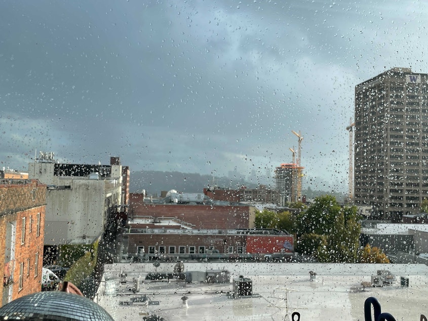
The last weekend of summer sure made a splash in the Seattle area and across much of western Washington.
Storms brought about as much rain as the area gets in all of September. And after several months with little moisture, the pitter-patter of the rain was music to meteorologists' ears.
Mike McFarland with the National Weather Service in Seattle says the deluge is a good start to fall — more than good, actually.
"The system that came through over the weekend was just kind of juicy and special," he says.
According to the NWS, Seattle got 86% of its average September rainfall in just two days. The storms were even punctuated by some booming thunder.
Bellingham soaked up more 100% of its average total for the month, with just over two inches recorded there.
Quillayute was especially wet and wild, with more than three inches of rain, though that's just 73% of that area's average for September.
Don't plan on much more rain until October, though, McFarland says.
"It should be pretty nice weather for the rest of the month," he says. "I think we'll probably have to wait 'til October for the typical seasonal rains to begin."
Nothing "special" about rain in October, when Seattle's average jumps to more than three inches of rain.
The moisture this weekend bodes well for the fall in any case.
Sponsored
McFarland says this year's dry summer spell is officially behind us, even if our changing climate indicates long-term drought and increasingly hot summers are sticking around.
"We can forget our drought and just proceed as we normally would now," he says, noting the weekend weather brought relief to eastern Washington, too.
The NWS in Spokane recorded record-breaking rainfall Saturday; a modest record just shy of half an inch.
Downpours east of the Cascades helped firefighters gain ground on the Schneider Springs Fire, which is burning more than 100,000 acres. And the rain quenched the thirst of some farmers whose crops have been suffering in the heat for the last three months.
Sponsored
McFarland noted that part of the state got help from a system about a week ago, too; so the additional inches this weekend put them on firmer — or rather, moister — ground.
The cherry on top of the weekend system may have been what appeared at the top of Mt. Rainier.
The mountain's crown of snow has been missing for weeks after extreme summer heat depleted the snowpack.
On Friday, Washington State Climatologist Nick Bond told KUOW it was really starting to look "sad" with its dark glacial ice exposed.
Not so anymore. That glacial ice has been tucked back in under a blanket of fresh white snow.
-
Katie Campbell

Online Editor/Reporter
Katie joined KUOW's online team as an editor and reporter in 2024, after serving three years as senior producer of the local Morning Edition program. She has covered a variety of local topics, including the Seattle City Council, elections, and breaking news. She also brings readers some levity with a weekly news quiz.
More stories from Katie Campbell » -
Angela King

Morning News Host
Angela King is the local host of Morning Edition. She’s been a part of the northwest news scene since the early 1990s. A proud University of Washington alumna, with degrees in broadcast journalism and American ethnic studies, she started her career as a news writer in Seattle, before becoming a reporter and anchor in Seattle, Portland and Albuquerque.
More stories from Angela King »


