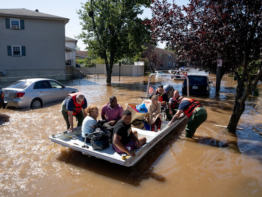
Why Hurricane Ida Hit The Northeast So Hard, 1,000 Miles Away From Its Landfall

How did Hurricane Ida's remnants create deadly havoc in Pennsylvania, New Jersey and New York, days after the system hit the Gulf Coast — some 1,000 miles away?
One reason is that "just the right mix of weather conditions" was in place to fuel the system, according to Tripti Bhattacharya, an assistant professor of earth and environmental sciences at Syracuse University.
"A storm like this would have been exceptionally rare 20 or 50 years ago," she told NPR. "But we have to start thinking about it becoming the norm as the climate warms."
Bhattacharya's research on regional rainfall and climate change was cited in the U.N.'s recent climate change report.
NOTE: This interview has been edited and condensed for clarity.
Sponsored
Where you surprised when you saw what Ida did in the Northeast, after devastating parts of the Gulf Coast?
Yeah, I was surprised. You know, hurricane remnants do provide a lot of the extreme rainfall in the Northeast, so I was expecting some extreme rainfall.
It turns out to have been just the right mix of weather conditions, where the remnants of Ida met another system, an extratropical front. They combined to create really extreme rainfall over New York and the surrounding areas.
Ida also spent time over a particularly warm patch of water in the northern Gulf of Mexico, and that allowed it to intensify very quickly.
From decades of research, we expect hurricanes to get more intense as a result of global warming. So in that way, Ida is not surprising.
Sponsored
Would a storm like this have been possible to imagine 20 years ago?
A storm like this would have been exceptionally rare 20 or 50 years ago. But we have to start thinking about it becoming the norm as the climate warms.
It's very simple physics: As the atmosphere warms, it can hold more moisture — and that means more fuel for rainfall.
We've all seen hurricane maps that show areas at risk. It seems harder to get people to prepare for a big rain event.
We're moving into a world we've never seen. When people say "flooding in New York City," what is our reference for that? I don't think anyone could imagine subways flooding that dramatically. I think it's a matter of getting people to take warnings more seriously, because now we've seen what can happen.
Sponsored
It also speaks to the importance of having really good infrastructure for weather prediction. The forecast tracks for this storm were remarkably good.
Flooding is hitting the Eastern U.S. while parts of the West are enduring extreme drought. Are those situations related?
Basically, because the atmosphere has more moisture in it from climate change, we get an amplification of historic patterns of wet and dry.
If you think about it in the global sense, there's more moisture moving into places like the Gulf Coast and the Eastern Seaboard. And more moisture is being pulled away from places like the West that are historically dry.
On the Gulf Coast, emergency crews and supplies were put in place ahead of the storm. Should more states do that sort of preparation?
Sponsored
Yes. We're only going to see more of the same, especially if we don't act to curb our emissions. As a country, having a real conversation about adaptation, both in terms of infrastructure and emergency plans, is really crucial.
There are big differences between how towns and homes are built in the Northeast and the Gulf Coast. What about those dynamics?
There's definitely a geography to risk. If you were in New York's uptown, you weren't seeing as much flooding as if you were in lower Manhattan or other parts of the city.
Paying attention to who's going to be hardest hit requires looking at vulnerability maps, and how that maps onto income — which affects your ability to leave at the drop of a hat. [Copyright 2021 NPR]


